Thematic research data commons is:
People
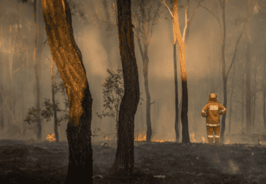
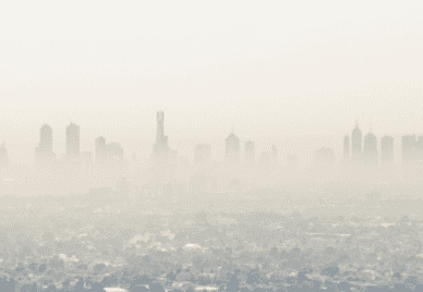
Reducing Deaths from Air Pollution
Exploreabout Reducing Deaths from Air Pollution
On 14 August 1829, James Walcott and Charles Dawson Ridley set sail from Portsmouth, England. Walcott had had a financial interest in several slave plantations in Demerara (now part of Guyana), and Ridley was the administrator of several others. But this time, they were not travelling to the Caribbean. Bringing their money, servants and equipment, they were bound for Western Australia.
Walcott and Ridley were part of a wave of British colonisers divesting from slavery, which was becoming economically and morally unsustainable, and turning their attention to settling in Britain’s new colonies in the early 19th century. Most likely using funds drawn from their estates in Demerara, they would claim and reshape what is now the suburb of Caversham in Perth and parts of the Avon Valley.
This is just one chapter of a larger story of how the people, capital and culture of British slavery were channelled into and left their mark on Australia – a story that the Western Australian Legacies of British Slavery project is reconstructing using the Time-Layered Cultural Map (TLCMap), an ARDC-supported suite of no-code or low-code digital mapping tools.[1]
Developed with an ARC Linkage, Infrastructure, Equipment and Facilities (LIEF) grant and later co-investment from the ARDC, TLCMap was launched in 2020 for HASS and Indigenous researchers.
One component of TLCMap was the Gazetteer of Historical Australian Places (GHAP), which has evolved into a standalone service with further co-investment from the ARDC. Based on the Australian National Placenames Survey (ANPS), GHAP provides access to over 330,000 historical and contemporary Australian placenames and their coordinates. It also allows the community to contribute Indigenous and historical names that are not in the ANPS database.
Professor Zoë Laidlaw, a historian at The University of Melbourne, found GHAP to be crucial to her team’s work on the WA Legacies project. As part of foregrounding the lasting impact of British slavery on Australia, 2 interns from the University’s Digital Studio identified colonial estates in Victoria that shared their names with British Caribbean slave plantations. Then, using GHAP, they located the estates.
“Combining other historical records with the location data from GHAP is helping the team identify which Victorian pastoral estates were indeed connected to Caribbean slave plantations and, conversely, when shared names are just coincidental,” said Prof Laidlaw.
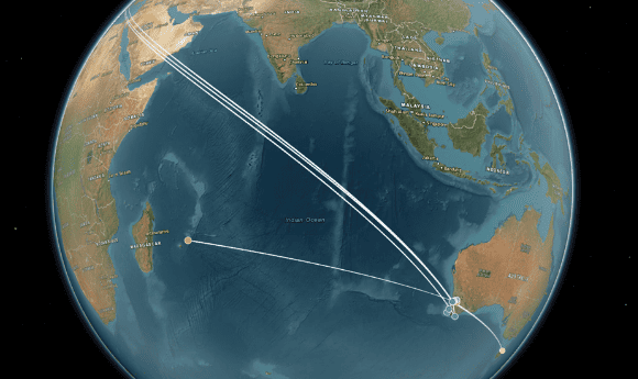
An interactive TLCMap by the WA Legacies team, charting the journeys from the Caribbean to Western Australia of 4 people with ties to British slavery
TLCMap also allows people, objects and events to be plotted on maps. This enabled the WA Legacies team to visualise the flow of British colonisers from the Caribbean to Australia.
Using TLCMap, Professor Paul Arthur and research associate Isabel Smith from Edith Cowan University charted the journeys of Walcott, Ridley and several other British colonisers who left the Caribbean for Western Australia. Drawing on the WA Legacies team’s biographical research, they were able to plot and timestamp every stop the colonisers made with annotations detailing their ties to slavery and their activities at each location. They then stacked the maps together using TLCMap’s multilayer function to compare the colonisers’ movement.
“We originally set out to develop our own visualisation tools that would help reveal aspects of this hidden history,” said Prof Arthur. “TLCMap is now fulfilling the need for spatio-temporal mapping at the national scale for researchers across disciplines.”
In 2021, TLCMap won gold for education services at the Good Design Awards. With more HASS and Indigenous researchers expected to take advantage of TLCMap and GHAP – both now hosted on the ARDC Nectar Research Cloud – the possibilities are endless for revealing patterns in our culture, society and heritage that tell important stories.
“We are embarking on a new LIEF-funded project this year to detect placenames in documents programmatically and link them to places in our gazetteer for instant mapping,” said Emeritus Professor Hugh Craig, Director of the University of Newcastle’s Centre for Linguistic and Literary Computing and leader of the TLCMap and GHAP projects.
“We are also developing ways of finding hotspots in spatio-temporal datasets and working on historical census data to add population numbers by year as a foundation map layer in the platform.
“Overall, the aim is to bring new digital tools and resources to bear on some of the central concerns of the humanities. We hope researchers will use these tools and resources for important new perspectives on Australian history and culture.”
Learn more about our co-investment in TLCMap and GHAP.
The Time-Layered Cultural Map received an ARC Linkage, Infrastructure, Equipment and Facilities (LIEF) grant and later co-investment from the ARDC [doi.org/10.47486/PL069]. It was a partnership of the ARDC, the University of Newcastle, The Australian National University, Edith Cowan University, the University of New England, The University of Melbourne, The University of Sydney, Western Sydney University, and the Australian National Placenames Survey.
The Gazetteer of Historical Australian Places [doi.org/10.47486/HIR007] is led by the University of Newcastle in partnership with the ARDC.
Written by Jason Yuen (ARDC). Edited by Mary O’Callaghan. Reviewed by Jo Savill (ARDC), Professor Zoë Laidlaw (University of Melbourne), Professor Paul Arthur (Edith Cowan University), Isabel Smith (Edith Cowan University), Emeritus Professor Hugh Craig (University of Newcastle), Mary Filsell (ARDC), Jenny Fewster (ARDC) and Keith Russell (ARDC).