Thematic research data commons is:
People
Reducing Deaths from Air Pollution
Exploreabout Reducing Deaths from Air Pollution
Until recently, Australians could almost be forgiven for thinking bushfires stopped at state borders. That’s because the bushfire authorities of each state and territory gather their own data separately and have management responsibility only within their own boundaries. The media reports reflected that. Even the fire danger rating systems differed between states.
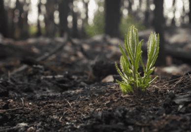
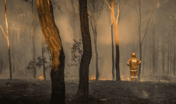
But the Black Summer fires of 2019–2020, which burned more than 240,000 square kilometres across multiple states and territories, clearly demonstrated the limitations of such an approach. A high level of information sharing and management between jurisdictions became a necessity.
Looking at that response and discussing needs with bushfire analysts, modellers and planners, the ARDC recognised the value of pulling together all the state/territory-based data into a harmonised, accessible national dataset documenting Australia’s bushfire history, said director of the Bushfire Data Challenges program Dr Sheida Hadavi. And the expertise to do so was available in the national bodies of Geoscience Australia and the Emergency Management Spatial Information Network Australia (EMSINA).
So, in 2021 the ARDC initiated, facilitated and invested in a $6 million program to deliver such a dataset, as well as alongside other data, tools and platforms for bushfire data. The bushfire history dataset was created using data from trusted state and territory agencies, who each contributed their own government database to Geoscience Australia through EMSINA. Geoscience Australia specialists then combined and standardised the data using advanced geospatial software.
The historical bushfire dataset documents fires from 1899 to 2022. It is available for anyone to access and use through the Digital Atlas of Australia, a new online geospatial platform being developed by Geoscience Australia. Currently in its beta phase, the atlas allows anyone to layer the historical bushfire data with other curated trusted national datasets on Australia’s geography, population, economy and environment. This integration will help unlock the full potential of the historical bushfire dataset, enabling a better understanding of collective challenges across borders and empowering proactive and informed decision making.
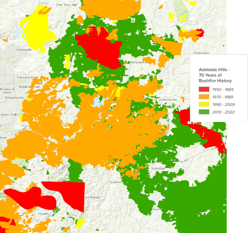
The creation of the bushfire history dataset means that for the first time, researchers and emergency management professionals can look beyond borders to understand bushfire behaviour and plan accordingly.
“With how everything was set up before, you couldn’t really look beyond your own border,” said ACT Rural Fire Service fire behaviour analyst and modeller Ailish Milner. “But as ACT fire planners, we can’t just look at our own patch. We are a small jurisdiction with a large border with New South Wales. The fire history data allows us to adjust fuel accumulation rates for different vegetation types so we can put the best fuel inputs into the different fire behaviour models we use.”
The impact of the dataset will extend far beyond bushfire modelling. Energy Queensland has already been using it to assess when their electricity poles were last exposed to bushfire.
Knowing where, when and how frequently fire has struck is important in determining Australian Fire Danger Ratings and assisting disaster recovery, as well as for carbon accounting, planning controlled burning, Indigenous land management, water utility management, urban planning, determining insurance risk, and conserving nature and protecting species.
Creating the bushfire history dataset was only one of the 5 work packages on bushfire behaviour included in the Bushfire Data Challenges program. Another group worked on determining what information needed to be included and in what form. Yet other groups identified gaps in the data and secured resources to help fill them. And, a team has been looking at how remote sensing can best contribute to the assembly and assessment of bushfire data.
The bushfire work will be further developed by the CSIRO-based National Bushfire Intelligence Capability (NBIC).
In November 2023, the joint ARDC, EMSINA, GA and Minderoo team won the Geospatial Council of Australia’s ACT ‘Environment and Sustainability Award’ for developing the first version of the ‘National Historical Bushfire Boundaries’ dataset.
Download the Historical Bushfire Boundaries data and view it on the Digital Atlas of Australia.
More projects from the Bushfire Data Challenges program are launching in 2023, including:
Learn more about Bushfire Data Challenges.
This project received co-investment from the ARDC (doi.org/10.47486/DC001) and a contribution from Minderoo Foundation. It was led by Geoscience Australia and Emergency Management Spatial Information Network Australia was a partner.