Time-Layered Cultural Map (TLCMap) 2.0
Tools for HASS researchers to map Australian history and culture
Who will benefit
Researchers, research organisations, government (state/territory and federal), general public
Program
The Context
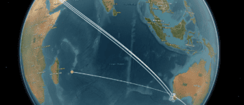
The Time-Layered Cultural Map platform (TLCMap) is a software ecosystem meeting the digital mapping needs of humanities and social science (HASS) researchers, from beginner to advanced.
Its unique in offering the means to visualise and interrogate historical and cultural data organised through spatio-temporal coordinates. It serves humanities and social science researchers who have an interest in using spatio-temporal data, but lack spatial and digital data skills.
The Project
TLCMap is a no-code or low-code ‘data fusion’ platform allowing researchers to:
- connect to multiple data sources
- use pre-existing or custom-made spatio-temporal tools to analyse and visualise data with minimal programming knowledge
- export results to standard analytics tools
- enrich data sources with spatio-temporal tags.
We’ve worked with partners to enhance TLCMap through improved connectivity to external platforms and archives such as the Historical and Colonial Census Data Archive, AusStage, The Prosecution Project, and national place name authorities.
New features in the handling of spatial and temporal data have been added such as a Quick Coordinates tool. Barriers to entry for humanities and social science researchers have been further lowered through better pathways in the website, and adding tutorials and documentation.
The Gazetteer of Historical Places was identified as the most useful and desirable part of TLCMap through user consultation and workshops. The Gazetteer enables search of the most comprehensive and complete aggregate of placenames in Australia, and of being an ever-growing spatio-temporal index of places of cultural significance to Australia.
We reengineered the Gazetteer as the centrepiece of TLCMap that other systems would attach to. This included:
- revising the underlying data structure
- establishing unique identifiers
- adding visualisation options
- streamlining and documenting the process for contributing to it.
Outcomes
This project has updated the Time-Layered Cultural Map of Australia to make it easier to create and find humanities information based on place and time, improving the understanding of the history and meaning of places in Australia. Use the new TLCMap.
TLCMap 2.0 will allow HASS researchers to uncover new patterns in their data, answer some long-standing research questions, and communicate their findings with more impact.
Who Will Benefit
Now an entire software ecosystem in one package, TLCMap caters for the digital mapping needs of the entire HASS sector, including librarians, amateur historians and students. The core features allow users to:
- easily create maps from humanities information
- search an online spatiotemporal window to Australian humanities research and datasets
- build digital spatio-temporal maps and create interactive visualisations without advanced spatial data skills on the web.
The Partners
- University of Newcastle
- Australian National University
- Edith Cowan University
- University of New England
- The University of Melbourne
- University of Sydney
- Western Sydney University
- Australian National Placenames Survey
Contact the ARDC
Timeframe
February 2021 to January 2022
Current Phase
Complete
ARDC Co-investment
$100,000
Project lead
University of Newcastle