Thematic research data commons is:
Planet
Workshop Addresses Wildlife Camera Trap, Ecoacoustic and Drone Data Challenges
Exploreabout Workshop Addresses Wildlife Camera Trap, Ecoacoustic and Drone Data Challenges
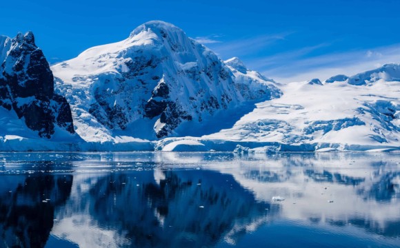
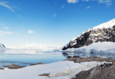
Polar ice melts, sea level rises: this is a portrait of the climate crisis we’re all familiar with. But exactly how much of a rise are we dealing with? It’s an important and urgent question for the millions of people living in coastal areas around the world.
And while we’re adapting to climate change, we also need to mitigate it. One way is, of course, to transition to renewable energy. But how are we going to get it?
There are no simple answers. Contrary to what many may think, Earth is not a giant bathtub where the water level rises uniformly across all places as you fill it; and while we can all name a few sources of clean energy, the process of reliably acquiring it – from discovering the rare minerals needed for the technology down to the geometry of the machinery – is complicated.
To answer these questions, researchers need advanced computational methods, which can take a lot of time, money and skill to develop and use. This is what an international team led by the Australian National University (ANU)’s Research School of Earth Sciences (RSES) and supported by the ARDC set out to address by developing G-ADOPT, a platform that helps with the computation needed to answer these complex and, indeed, multidisciplinary questions.
‘G-ADOPT’ is short for ‘Geoscientific ADjoint Optimization PlaTform’. At first, though, the ‘G’ stood for ‘Geodynamic’ when the platform had a tighter focus. Geodynamics is a branch of geoscience that studies the flow of matter in Earth’s interior and its impact at the surface. It’s an inquiry that depends heavily on modelling as well as observational data.
“Suppose we have some observations from the geological record of an event that happened millions of years ago, and we want to understand the processes that gave rise to the event. What we’d normally do is come up with a model of those processes based on some physical assumptions, run the model, compare the results with the observations, and refine the model until they match,” said Professor Rhodri Davies of ANU’s RSES, who leads the G-ADOPT team.
But there’s a catch with this kind of modelling, known as ‘forward modelling’. Notice the model is based on guesses, and the observations are not used to underpin it but, rather, to validate the guesswork.
“We can actually formally integrate the observational data into the model via an optimisation procedure, which is a more mathematically rigorous way of making sure it matches reality,” said Prof Davies of a reverse, more proactive type of modelling – inverse modelling.
Powerful as it is, though, inverse modelling is notoriously difficult and expensive. There were only a handful of approaches to it in geodynamics, and even with those, you’d have to significantly simplify the problem you’re solving for them to be computationally tractable. This is where G-ADOPT, supported by an ARDC co-investment through the Platforms Program, comes in.
“By combining the dolfin-adjoint software library, which provides a state-of-the-art inverse modelling method, and Firedrake, which can automatically generate the code for the modelling, G-ADOPT takes away much of the difficulty associated with deriving and implementing the inverse model. You no longer need to be a specialist in computer science or applied mathematics to do it, you don’t have to work for months to figure out the maths, and you can be sure the automatically generated code is far more optimised than anything humans can come up with,” said Prof Davies.
“For the first time, the broader geodynamics community can fully harness the surge in accessible observational datasets for more realistic, data-driven models.”
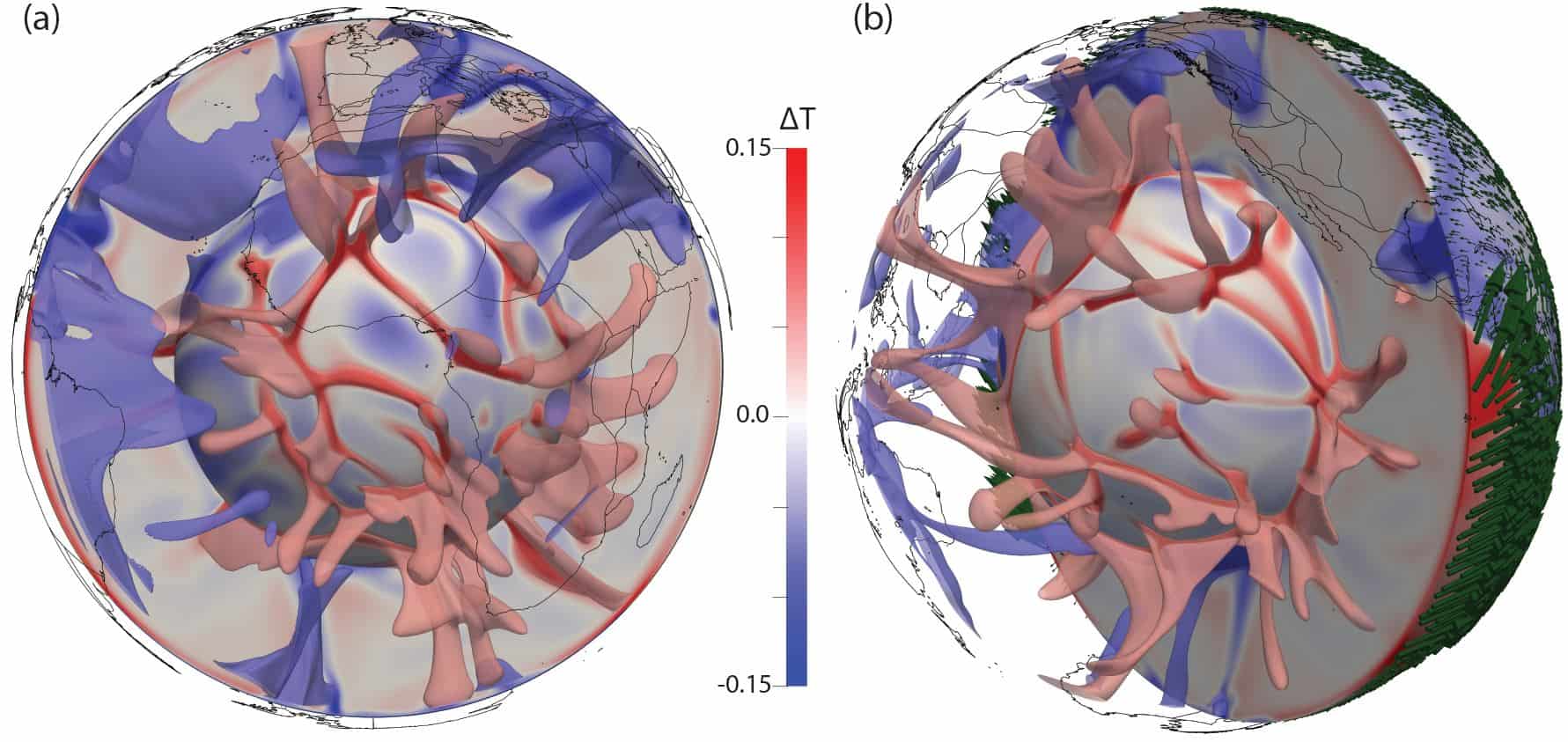
Using G-ADOPT, researchers can now make robust reconstructions of the little known evolution of Earth’s mantle, a thick layer of hot rock between the crust and the core that’s been convecting and, in turn, driving geological activities at Earth’s surface. More importantly, inverse modelling isn’t exclusive to geodynamics, meaning that G-ADOPT can be applied across earth sciences.
One such application is understanding how the melting of polar ice influences sea level, which is the focus of a further 3-year project supported by the Australian Centre for Excellence in Antarctic Science (ACEAS).
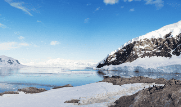
We all know sea level is rising as polar ice melts, but the rate of this isn’t the same everywhere. In fact, some locations are experiencing a drop in sea level. This is because sea level changes are determined, in part, by changes in Earth’s gravity, which are themselves uneven for many reasons, not least the melting of polar ice itself.
Ice has mass and, therefore, a gravitational attraction. When polar regions lose their ice to the ocean through melting, they also lose a part of their gravitational attraction on surrounding waters and actually lead to a drop in local sea level. Meanwhile, this is compensated by an additional sea level rise elsewhere on top of that contributed by the melted ice.
Another reason is as Earth moved out of the last ice age 10,000 years ago and glaciers retreated, land that had been dented by the glaciers started rebounding. This phenomenon is called glacial isostatic adjustment (GIA) and is still going on to this day. It also causes redistribution of Earth’s mass and uneven changes to the planet’s gravity field, leading to varying sea level changes.
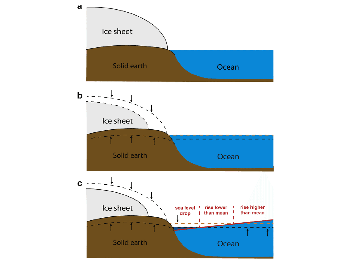
“As you can see, how sea level responds to the melting of polar ice is both a geodynamic and a climatological question. Capable of handling equations from different domains within the same framework, G-ADOPT is uniquely positioned to help create models for this cross-disciplinary problem – robust models that are driven by the growing body of observational data on past ice-sheet behaviour,” said Prof Davies.
“We’re just months into the project and obviously haven’t solved everything, but we already have a framework that, using just a few lines of Python code, matches the results of modelling code currently used by the community. It’s looking very promising.”
G-ADOPT is also being used to answer questions about renewable energy. In one project, the team is working with The University of Sydney to couple G-ADOPT with GPlates, an AuScope-supported plate tectonics reconstruction software shortlisted for the 2023 ARDC Eureka Prize for Excellence in Research Software. By integrating GPlates’ plate motion data with models of the mantle, the team is working to accurately predict the distribution of underground material, which may imply the distribution of rare metals and minerals required for renewable energy technology, much in line with the National Science and Research Priorities. On another front, G-ADOPT partners at Imperial College London in the UK are using observations of ocean currents to model the placement of tidal turbines for maximum energy output.
“With G-ADOPT, we’re really opening up inverse modelling to researchers with little to no experience in model development. This is a game-changer, allowing for data-driven simulation across different fields of geosciences,” said Prof Davies.
G-ADOPT is a partnership between 5 Australian and overseas universities, 3 National Collaborative Research Infrastructure Strategy (NCRIS) facilities, and the Australian Government. The partners are:
All the major targets of the G-ADOPT project have been met. “There’ve been technical challenges and hurdles like bringing our international team together during the pandemic, but we’ve overcome them and shown the power of our approach. In short, we have demonstrated that G-ADOPT works. We’ve developed the first fully consistent adjoint inverse model for geodynamics, and there’s a lot of interest in the platform from across earth science. It’s been a success,” said Prof Davies, noting the importance of the ARDC’s co-investment in enabling this transdisciplinary project.
And this is just the beginning. The team is now working to deliver a dataset that reconstructs the evolution of Earth’s mantle over the last 60 million years, revealing how geodynamic processes within Earth’s interior impact the surface across different spatial and temporal scales. This will exploit the new functionality within G-ADOPT that spares users the trouble of rerunning the entire model, which is costly and time-consuming, should they need to refine it with new observations.
G-ADOPT has also recently received funding from AuScope in the 2023 NCRIS Research Infrastructure Investment Plan (RIIP) funding round to participate in building the modelling component of the national Coastal Research Infrastructure (CoastRI). This will support further development and maintenance of G-ADOPT’s research software infrastructure for simulating glacial isostatic adjustment and solid Earth impacts on sea level.
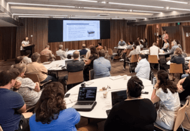
The team will also continue to hold workshops as they did in April 2022 and September 2023. These workshops will explore further applications of the platform, provide opportunities to showcase ongoing developments, and offer training and support to users and a growing number of developers within the Australian and international communities.
Kerry Levett, Solutions Architect for the ARDC Planet Research Data Commons, led the ARDC’s Platforms Program, through which G-ADOPT was developed.
“We’re pleased to have played a part in bringing about this groundbreaking tool, which is set to transform modelling practice across earth sciences and help address some of the biggest problems facing our planet. Building on its experience supporting G-ADOPT and other platforms, the ARDC is delivering an integrated approach to modelling in earth and environmental sciences as part of the Planet Research Data Commons,” said Ms Levett.
Learn more about and use G-ADOPT.
The next G-ADOPT workshop will take place the ANU’s Kioloa Coastal Campus from 10 to 12 November 2024. Learn more and register now.
The ARDC is funded through the National Collaborative Research Infrastructure Strategy (NCRIS) to support national digital research infrastructure for Australian researchers.