Thematic research data commons is:
Planet
Workshop Addresses Wildlife Camera Trap, Ecoacoustic and Drone Data Challenges
Exploreabout Workshop Addresses Wildlife Camera Trap, Ecoacoustic and Drone Data Challenges
Bushfires are an intrinsic part of Australia’s environment, yet the unprecedented bushfire season of 2019-2020 resulted in an ecological disaster and devastating loss of life, property and wildlife.
How can firefighters, emergency managers, decision makers and general Australians prepare for subsequent fire seasons?
Science and technology, and the huge amount of data underpinning them, can help mitigate the destruction caused by bushfires and inform first responders, decision makers and communities.
Every day, vast amounts of environmental data is collated by researchers in universities, CSIRO and government departments and agencies such as Geoscience Australia (GA) and the Bureau of Meteorology (BoM). The types of data being collated range from vegetation coverage and rainfall through to ocean temperatures and impact of bushfires on biodiversity.
Analysing and processing large and complex data to make sense of it requires certain tools, software and computing power. For example, the Australian National University’s Water and Landscape Dynamics group (ANU WALD) created the Australia’s Environment Summary Report 2019 and their website by analysing huge amounts of publicly accessible and trusted data from BoM, GA and a range of nationally funded research infrastructures such as Integrated Marine Observing System (IMOS) and the Terrestrial Ecosystem Research Network (TERN).
The group used the National Computational Infrastructure’s (NCI) supercomputer to integrate and analyse the datasets and produce algorithms and models. In particular, time-series data enabled patterns of change in Australia’s ecosystems to be assessed, which is critical to understanding and managing our environment.
Another example is Digital Earth Australia Hotspots, a web-based platform that supports fire agencies ability to respond to, and prepare for, bushfires by providing situational awareness for active bushfires and a historical archive on bushfire hotspots. The platform has revolutionised the way that fire information is visualised and risk is understood because it features access to NASA and other satellite data streams through Australian ground stations, data-processing algorithms and a customised interface.
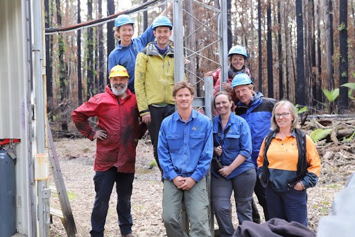
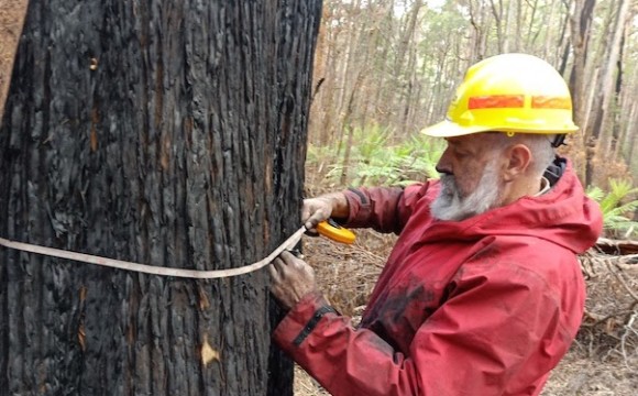
And let’s not forget about collecting data, post bushfires. Automated sensors and detailed field surveys give scientists an unprecedented understanding of post-fire recovery and resilience of the Australian environment.
Researchers from the University of Tasmania have used TERN’s monitoring infrastructure to collect post 2018-2019 bushfire data in Tasmania to assess fire impacts and ecosystem recovery, and facilitate vital new science.
Publicly available and trusted data is one of the most important and vital aspects of any research study and its value is unprecedented. Learn more about the value of research data.