Thematic research data commons is:
Planet
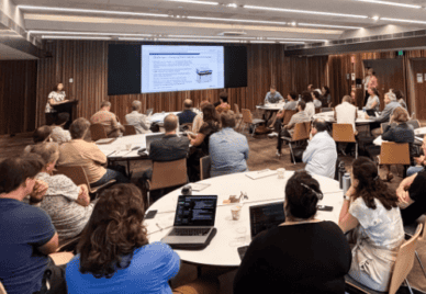
Workshop Addresses Wildlife Camera Trap, Ecoacoustic and Drone Data Challenges
Exploreabout Workshop Addresses Wildlife Camera Trap, Ecoacoustic and Drone Data Challenges
Hope rises like a phoenix from the ashes of shattered dreams.
SA Sachs
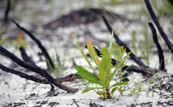
When Casey Kirchhoff lost her NSW Southern Highlands home in the Morton Fire in January 2020, her passion for the environment and determination to find something positive propelled her into action.
Casey, a PhD candidate at the University of New South Wales (UNSW) School of Biological, Earth and Environmental Science, went out into the blackened bush and looked for signs of life.
Using the iNaturalist app, Casey started monitoring and tracking nature’s efforts to fight back against the devastation. She found and documented new shoots on ferns, wombats bunkered down in their burrows, glossy-black cockatoos in full flight and brilliant orange fungi on the woodland floor.
“Seeing these things gave me hope, but they also highlighted the importance of monitoring the recovery of our biodiversity in the wake of the fires,” Casey said.
“I realised I was probably just one of many people collecting this information. So, I thought, why not ask citizen scientists to share their photos? The bushfires have burnt such a large area; it’s impossible to properly survey it with our current resources,” she said.
Casey, together with a team from the Centre for Ecosystem Science at UNSW, created a way to manage and use this valuable data, the Environment Recovery Project. The project, which is hosted on the iNaturalist Australia platform, was officially launched on 31 January. The Australian network is supported by Australia’s leading citizen science platform, the Atlas of Living Australia (ALA), which gives the public access to a wide range of accessible and reusable biodiversity information. The NCRIS-supported ALA is a collaborative, digital, open infrastructure that amalgamates Australian biodiversity data from multiple sources to support research and decision making.
“The more observations we can collect, the more we will know about the impact of the fires on our environment,” Casey said.
According to Prof Richard Kingsford, the director of the UNSW Centre for Ecosystem Science, the project allows everyone to increase knowledge about how the environment responds to devastating events. It provides valuable information about how some areas recover better than others and tracks the rate that some animals and plant species recover and return.
“The key aims of this initiative are to understand which plant species are sprouting and growing seedlings, to calculate when and how animals return to burnt areas and to highlight which species are struggling to recover and might need our help,” Richard said.
As of 8 October the project included 8,571 observations of more than 1640 species from more than 300 citizen scientists.
“The platform is really user-friendly, for administrators and citizen scientists,” Casey said.
The project team recently compared satellite data from the Digital Earth Australia Hotspots, a part of a national bushfire monitoring system that tracks bushfire intensity, with the project’s on-the-ground observations. The results, which will be published in early 2021, found that the citizen scientist-collected data on fire severity accurately matched the satellite data.
“It shows how useful citizen science is,” Casey said.
The ARDC has just launched an initiative that focuses on bushfires. The Bushfire Data Challenge program is designed to develop innovative digital infrastructure solutions to current data challenges in bushfire research, to help improve Australia’s bushfire resilience, response and recovery.